
Key Features
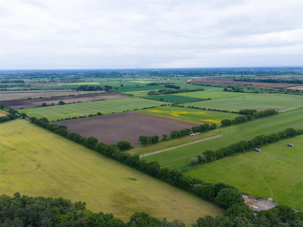
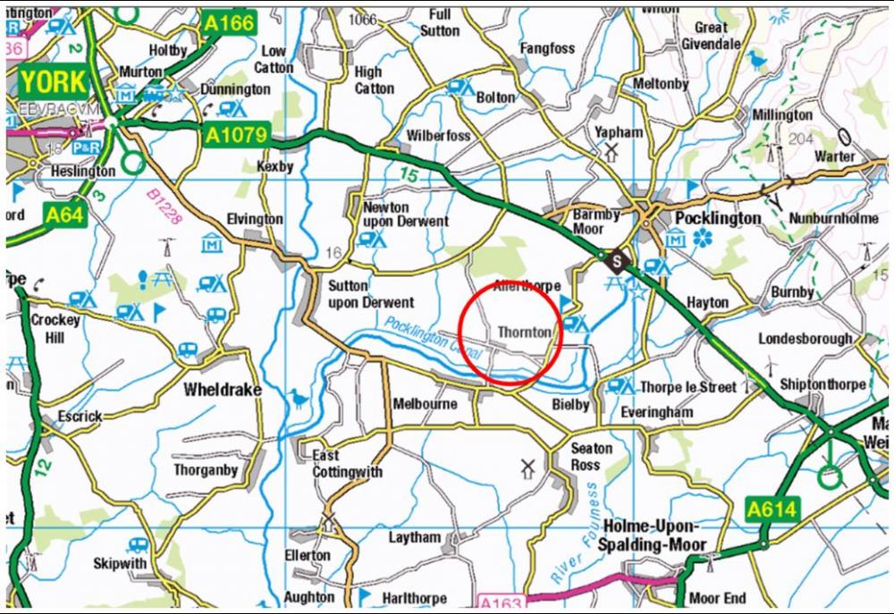
490.12 Acres of Agricultural Land between the villages of Thornton & Allerthorpe, Pocklington. An opportunity to acquire land in the fertile area to the south of Pocklington, around the villages of Thornton and Allerthorpe. Offered as a Whole or in 11 lots to suit purchasers, covering versatile arable capable of cash root cropping or turf production; and Ings grass with environmental potential.
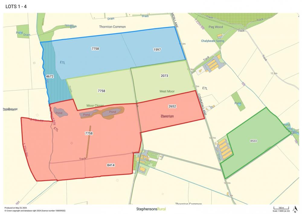
Lot 1 – 67.43 acres of arable and grass land west of Common Lane, Thornton.
Guide Price £715,000
Lot 2 – 47.95 acres of arable land west of Common Lane, Thornton.
Guide Price £630,000
Lot 3 – 114.65 acres of arable and grass land west of Common Lane, Thornton.
Guide Price £1,180,000
Lot 4 – 26.93 acres of arable land east of Common Lane, Thornton.
Guide Price £300,000
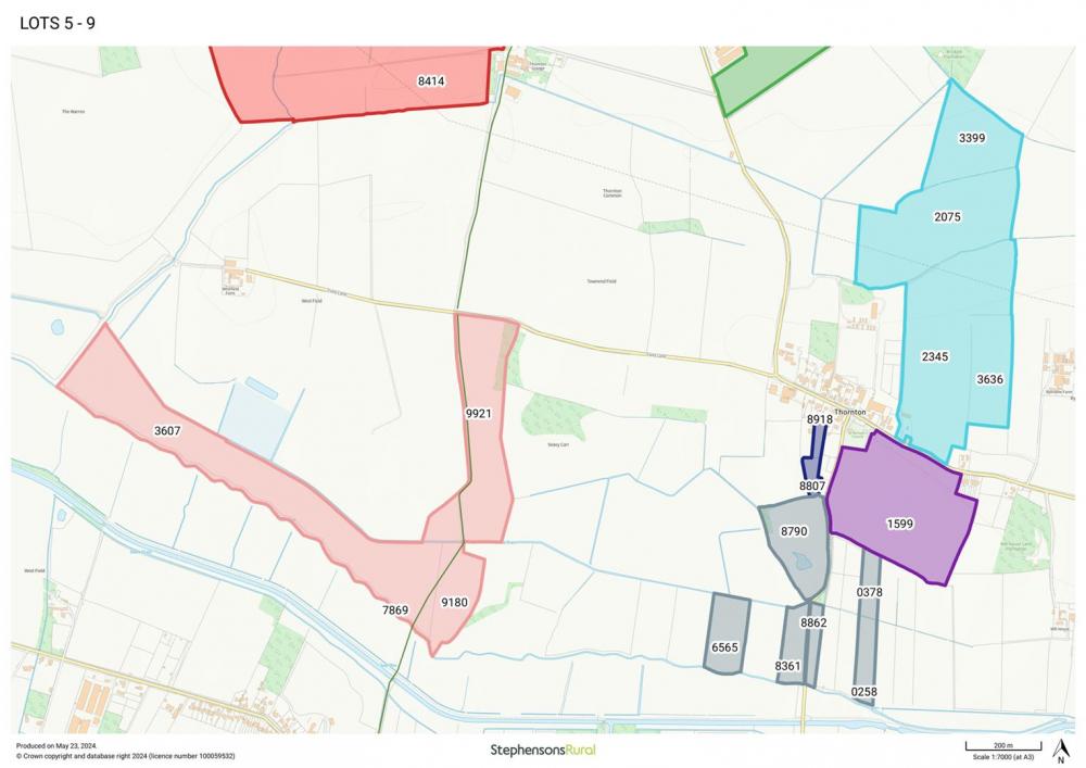
Lot 5 – 65.61 acres of arable and Ings land south of Field Lane, Thornton.
Guide Price £350,000
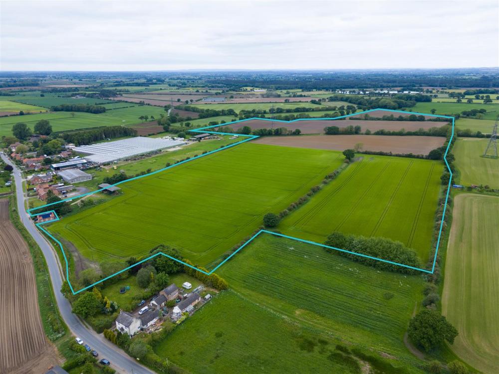
Lot 6 – 69.36 acres of arable land together with a yard and Dutch Barn north west of Thornton village.
Guide Price £800,000
Lot 7 – 1.78 acres of grass paddocks directly to the south of the village of Thornton.
Guide Price £30,000
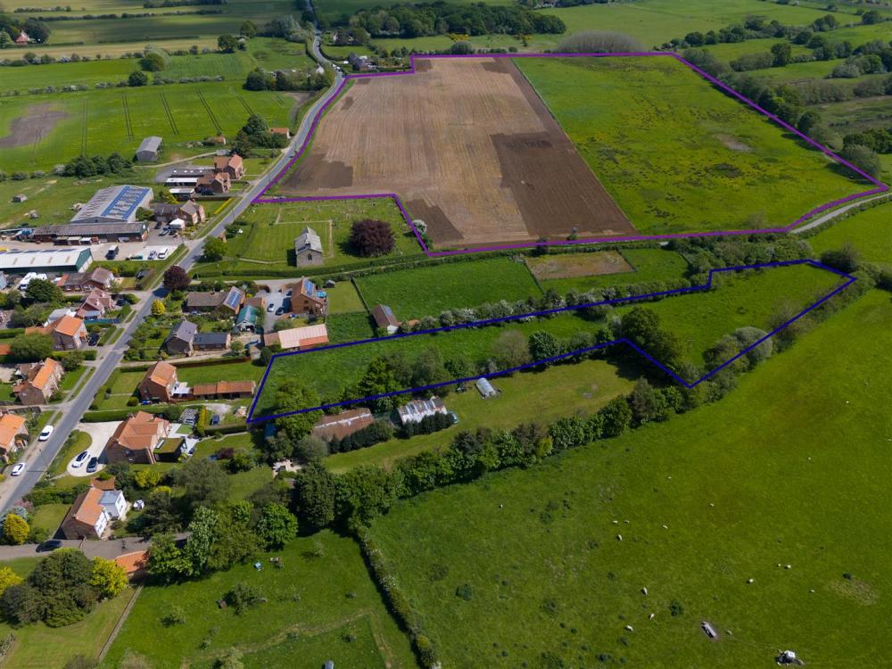
Lot 8 – 26.29 acres of arable land south east of Thornton and fronting Church Road.
Guide Price £250,000
Lot 9 – 24.14 acres of Ings land with access from Church Road and over the Green Lane.
Guide Price £140,000
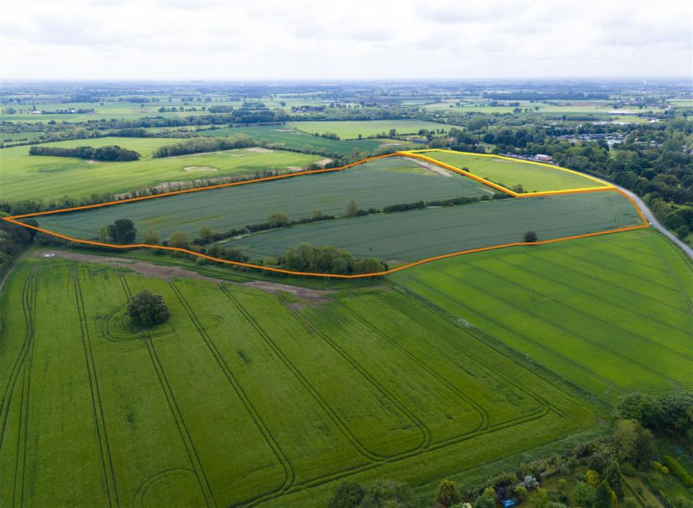
Lot 10 – 9.98 acres of land currently used as a golf driving range with access directly from the Allerthorpe—Melbourne Road.
Guide Price £150,000
Lot 11 – 36.00 acres of arable land with access directly from the Allerthorpe—Melbourne Road.
Guide Price £450,000
The Whole - 490.12 Acres
Guide Price £4,995,000
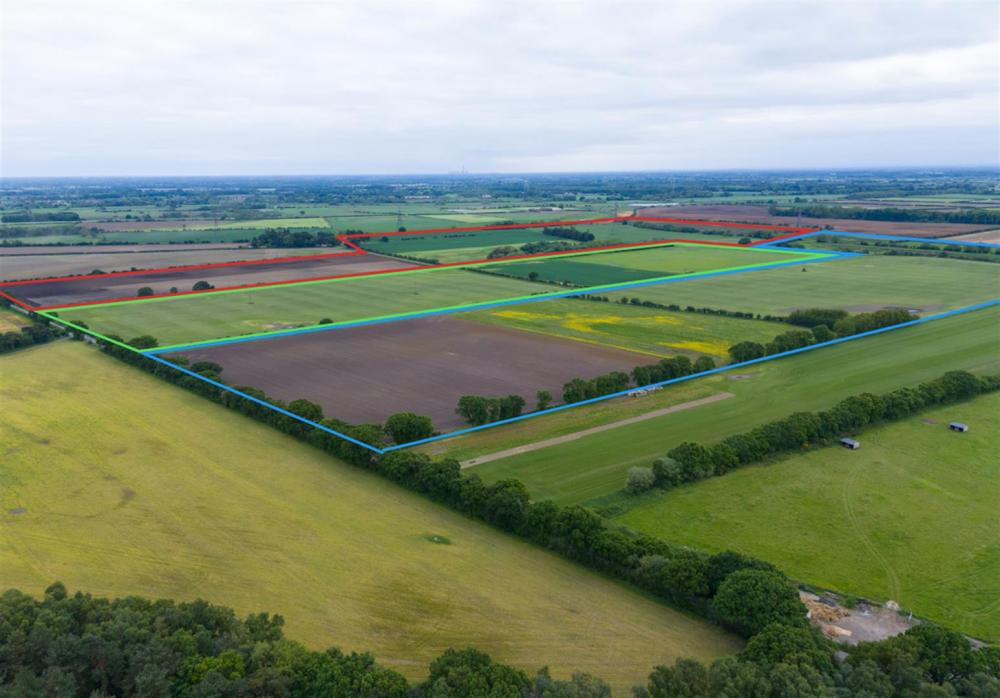
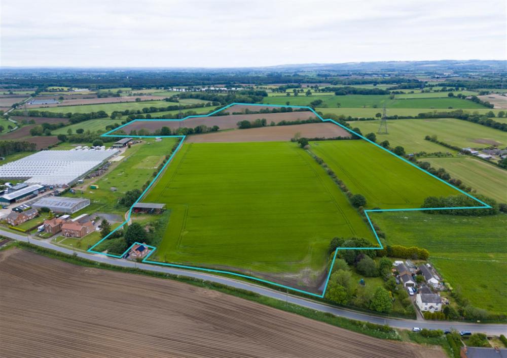
LOT 1 – 67.43 acres of arable and grass land
67.43 acres of arable and grass land west of Common Lane (edged and shaded blue)
A block of 55.87 ac Grade 3 arable land together with 11.56 ac of grass. The arable land is of good quality and is suitable for root cropping. The land is accessed directly off Common Lane. See paragraph on Rolawn Contract for further detail on turf.
LOT 2 – 47.95 acres of arable land
47.95 acres of arable land west of Common Lane
(edged and shaded light green)
2 arable fields accessed directly off Common Lane. The land is of good quality with versatile soils suitable for root cropping. See paragraph on Rolawn Contact for further detail on turf.
LOT 3 – 114.65 acres of arable, grass & woodland
114.65 acres of arable, grass & woodland north of Thornton Grange
(edged and shaded red)
A block of Grade 3 arable land located to the north of Thornton Grange Farm with access off Common Lane. The arable land is of good quality and suitable for root cropping whilst the grassland offers potential to be included within Countryside Stewardship or SFI options. See paragraph on Abstraction Licence for details of irrigation pond.
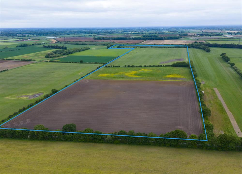
LOT 4 – 26.93 acres of arable land
26.93 acres of arable land east of Common Lane
(edged and shaded green)
A single Grade 3 arable field known locally as the Turkey Sheds; accessed off Common Lane. See paragraph on Rolawn Contract for further detail on turf.
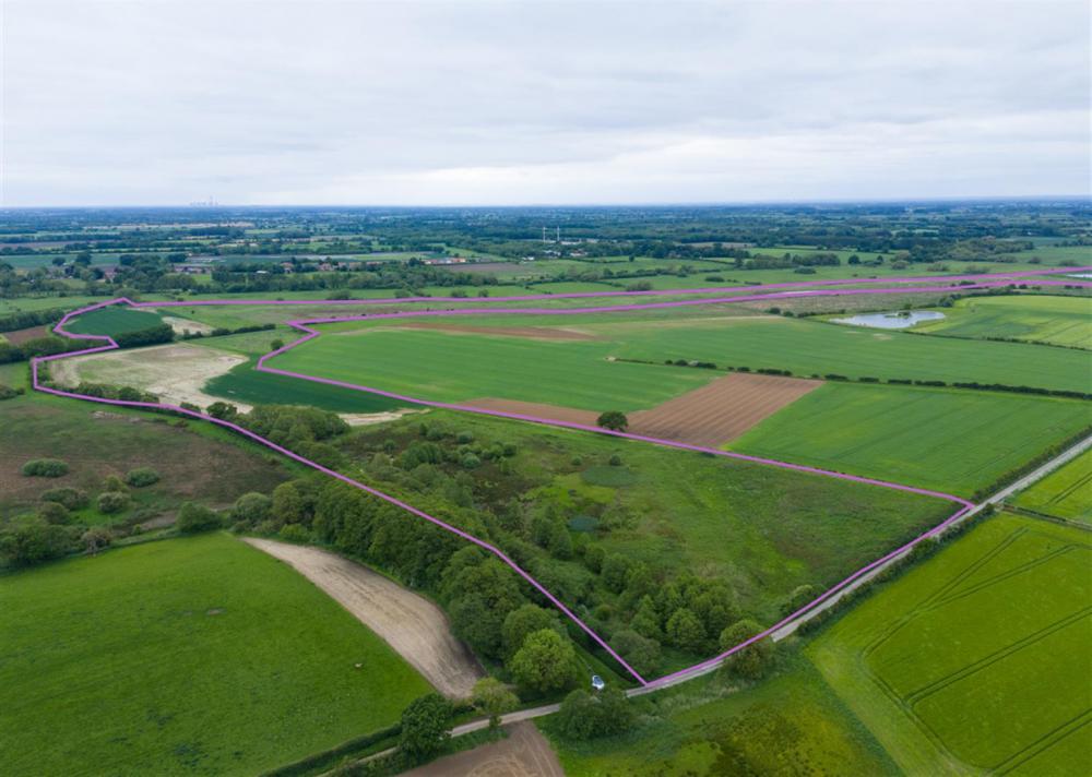
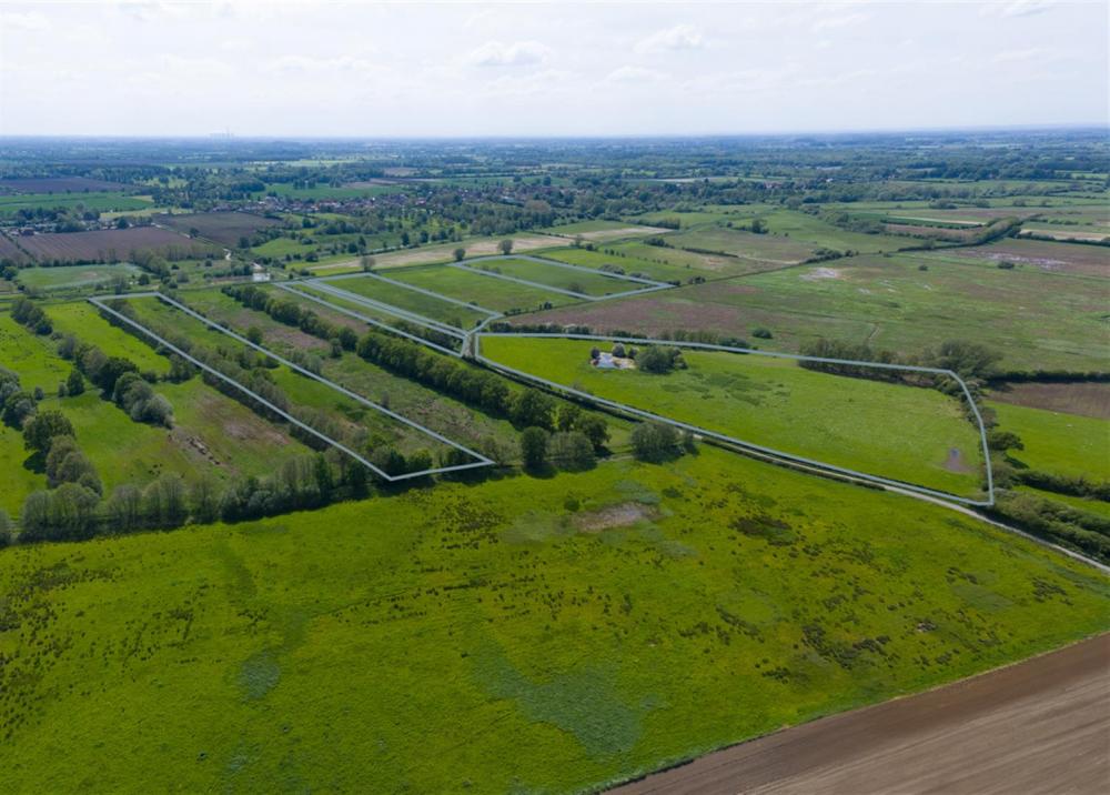
LOT 5 — 65.61 acres of arable and grass land
65.61 acres of arable and grass land south of Field Lane
(edged and shaded pink)
A block of 19.5 ac arable, 7.95 ac grass and 38.13 ac Ings, accessed from Field Lane and through internal farm tracks. The grass land has been grazed by livestock.
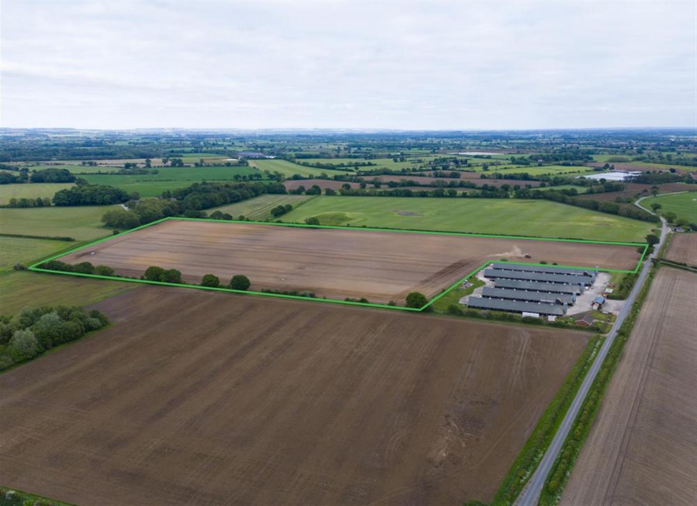
LOT 6 – 69.36 acres of arable land
69.36 acres of arable land north west of Thornton village
(edged and shaded light blue)
A block of good quality Grade 3 arable land accessed through the old farmstead north east of Thornton village. The land is of good quality with versatile soils suitable for root cropping. The farmstead comprises an open-sided Dutch Barn measuring 24.76m x 8.73m together with a small traditional building.
LOT 7 – 1.78 acres of grass land
1.78 acres of grass land south of Thornton village
(edged and shaded dark blue)
Two small paddocks located south of Thornton village. The parcels are well-fenced and suitable for equestrian and livestock grazing. Thornlea Cottage, adjoining and fronting Main Street is being offered for sale separately through our Malton office — please contact reception@boultoncooper.co.uk or 01653 692 151 FAO Henry Scott.
LOT 8 – 26.29 acres of arable land
26.29 acres of arable land south east of Thornton village
(edged and shaded purple)
A good Grade 3 arable field with 12.73 ac potatoes and 13.57 ac grass. The southern grassed area would benefit from drainage works.
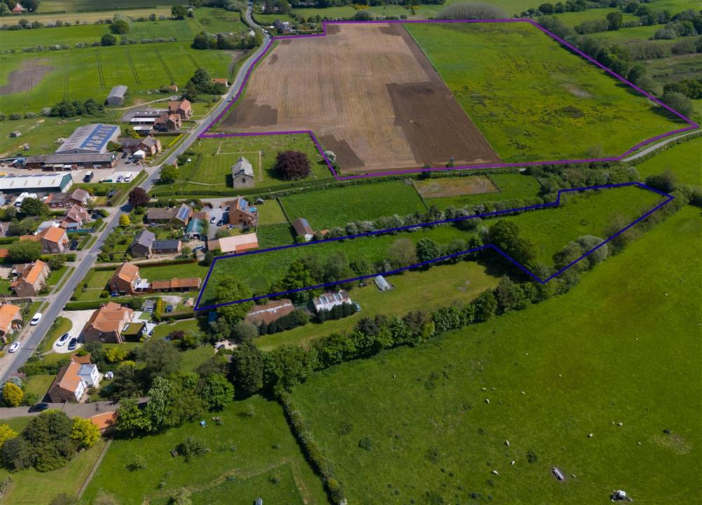
LOT 9 – 24.14 acres of grass and Ings
24.14 acres of grass and Ings south of Thornton village
(edged and shaded grey)
Mainly Grade 4 Ings land but with an 8.80 ac grass field nearer the village, known as Bolams. Accessed off Church Lane and via the green lane right of way by the Black Dyke. This lot may be further sub-divided to suit purchasers.
LOT 10 – 9.98 acres of grass land
9.98 acres of grass land - Golf Driving Range
(edged and shaded yellow)
A sound arable field with extensive road frontage just south of Allerthorpe village. Currently used as a Golf Driving Range and vacant possession will be available on completion.
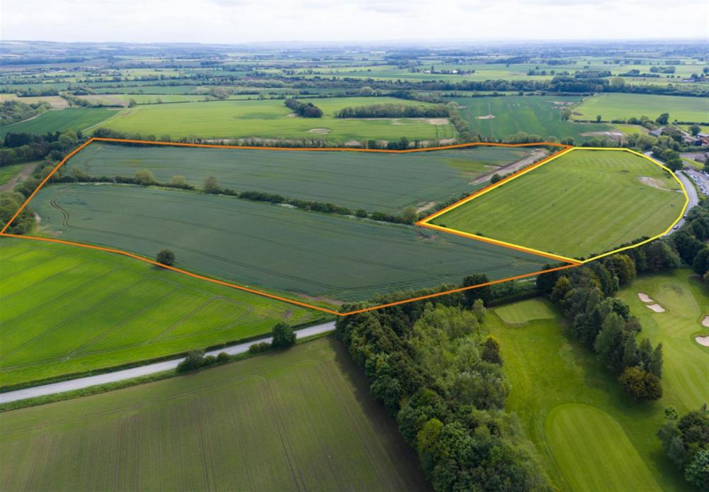
LOT 11 – 36 acres of arable land
36 acres of arable land adjoining Golf Driving Range
(edged and shaded orange)
An excellent block of Grade 3 arable in 2 fields, capable of growing root crops and cereals. Good road frontage just south of Allerthorpe village.
PLEASE SEE EXTERNAL BROCHURE FOR SEPARATE LAND SCHEDULES.
Entry to the Land
The Purchasers are to be given entry to the Land following completion and after the 2024 harvest with the exception of the land included in the Rolawn Contract.
Tenure
Freehold with vacant possession on completion.
Sporting and Mineral Rights
Sporting and mineral rights are included in the sale so far as they are owned.
Wayleaves and Easements
The land is sold subject to all wayleaves and easements whether mentioned in these sales particulars or not, which will include the following:-
Lot NG Ref Wayleaves/Easements
1 4672 & Pt. 7758 Overhead electricity cable.
2 2073 Overhead electricity cable.
3 3526, 7758 & 8414Overhead 132 kV electricity cable.
4 8533 Overhead electricity cable along southern boundary.
5 9921 Overhead electricity cable.
6 2075 & 2345 Overhead 132 kV electricity cable.
7 8807 Overhead electricity cable.
8 1599 Overhead electricity cable.
11 6073 Overhead electricity cable.
Public Rights of Way
Location indicated by the dark green line on the Lot Plans.
Lot NG Ref Public Rights of Way
1 1597 Public footpath along the southern boundary
2 2073 Public footpath along the western boundary
3 2652 Public footpath along the western boundary.
5 9921, 9180 & 7869 Public footpath along western boundary of 9921, north western corner of 9180 and south eastern corner of 7869
Access
Access to all lots except Lot 7 will be off council maintained roads. Lot 7 will be accessed via the driveway adjoining Thornton Cottage in Thornton village.
For Lot 9 there is a green lane access along Black Dyke off Church Lane.
Environmental Land Management Schemes
The land is not within any environmental scheme.
Nitrate Vulnerable Zone (NVZ)
We have checked the Environment Agency NVZ map which confirms the land lies within a NVZ which will limit excessive fertiliser application.
Flooding
Some areas of Lot 1, 3, 5 and 9 lie within Flood Zone 2 and 3; the remainder is all in Flood Zone 1, which states there is a less than 0.1% chance of flooding.
Soil & Land Classification
The land falls predominantly within Grade 3 of the Agricultural Land Classification and the soil lies within the Holme Moor, Kexby, Everingham and Landbeach series, generally defined as fine sandy or loamy soils suitable for cereal and root cropping, by the Soil Survey of England and Wales. The Ings land is classified as Grade 4.
Basic Payments Scheme
The land is registered on the Rural Land Registry. The Vendors claimed the 2023 Basic Payment (2023) and will continue to receive and retain any future de-linked payments under the Basic Payment Scheme. The ingoing purchaser will indemnify the Vendors against any non-compliance resulting in reduced payment from the date of completion.
Overage
For a period of 20 years the Vendors will be entitled to receive 50% of the uplift in value on land on which planning consent has been granted for a use other than agriculture, equestrian, horticulture or forestry. A fuller version of the clause can be obtained from the selling agent.
Solar
The land lies in close proximity to Thornton Sub-Station and the Vendors have been approached on a number of occasions in relation to a solar park in the area.
Services
The Vendors are not aware of any services to the land.
Drainage Rates / Outgoings
The land falls within the Foss Internal Drainage Board area and the current annual rate payable is approximately £2.16 per acre.
Abstraction Licence
There is an abstraction licence on Lot 3 expiring 31st March 2025 to take 18,360 cubic metres (4,039,000 gallons) water per year, from the easterly irrigation pond.
Method of Sale
The land is offered for sale as a whole or in 11 lots by Private Treaty. The Vendors reserve the right to conclude the sale by any means.
Cropping & Documents
Further information is available upon request from the Selling Agents, including 5-year cropping history.
Boundaries
The Vendors and Vendors’ Agent will do their best to specify the ownership of boundaries, hedges, fences and ditches but will not be bound to determine these.
Currently there are marker posts only on the boundary of field 7758 between Lots 1, 2 & 3.
Rolawn Contract
There are outstanding agreements with Rolawn for the production of turf on the following fields:
Lot 1 — Field 7758 (32.39 acres)
Notice has been given to terminate on 30th November 2024.
Lot 2 — Field 2073 (21.74 acres)
Notice has been given to terminate on 30th November 2024.
Lot 4 — Field 8533 (23.60 acres)
Notice has been given to terminate on 30th June 2025.
The current rental income of £315 per acre per annum will be apportioned to the purchaser from completion. Rolawn would be prepared to discuss a future contractual agreement.
Anti-Money Laundering Regulation
The Agent must comply with Anti Money Laundering regulations. As part of the requirements, the Agent must obtain evidence of the identity and proof of address of potential buyers. Prior to an offer being accepted, all parties who are purchasing must provide the necessary evidence.
Local Authority
East Riding of Yorkshire Council, County Hall, Beverley, HU17 9BA
Tel: 01482 393939
Viewing and Registration
By permit from the Agents only. Please note if you have downloaded these particulars from our website, you must contact the office to register or you will not be included on further mailings regarding this sale.
Please also register at www.stephenson.co.uk for regular email updates.
Plans and Measurements
The plans and measurements provided are for guidance only and are subject to verification with the title deeds. It must be the responsibility of any prospective purchaser to carry out an adequate inspection and site survey to satisfy themselves where the extent of the boundaries lie.
Vendor’s Solicitor
Grays Solicitors, Duncombe Place York, YO1 7DY
Agent Contacts
Stephenson Rural, York Auction Centre, Murton, York, YO19 5GF
PLEASE SEE BROCHURE FOR AGENT'S CONTACT DETAILS.

Loading... Please wait.
Loading... Please wait.